100 Miles on the NPT
- Andrew Meunier
- Jul 10, 2020
- 7 min read

Updated: Mar 9, 2024
My planned thru hike of the Northville Placid Trail came to an end yesterday two days and 38 miles short of my goal. I developed painful blisters on my little toes on the first day of hiking. It's hard to say why; the boots I wore were the same model I hiked in last year when I did many long hikes including the Saranac 6 and the Presidential Range traverse. This was a new pair and, although I did some spring hiking in them, perhaps I failed to break them in enough. I also think the hot road walk on the first day may have played a role. I nursed my feet along for days and was still able to enjoy much of my hike. But in the end, walking was getting to be tough and I was worried about infection. My pathetic morning shuffle (before my feet got "warmed up") was starting to feel ominous. I decided that Long Lake was a good place to get off the trail and let my feet heal. Fortunately, my wonderful wife was able to pick me up.
Even though I still have some of the NPT left to do, I certainly had a great adventure. I saw parts of the Adirondacks that I had never explored before. I haven't ever felt as isolated as I did on some of the most remote stretches of this trail.

My hike
I started in Northville on July 4th a bit before 9AM. Rashna and I had a teary goodbye and I was off down Bridge St. towards the Sacandaga Park. I saw many Northville citizens getting in their exercise before beginning their Independence Day festivities.

The sun was already quite hot and I was happy to duck into the forest after about 3.5 miles of road walking. I only paused briefly at Mud Lake (the first of many Mud Lakes!) to snack and later I stopped to treat a disconcerting blister that was developing on one of my little toes. At Mud Lake, I startled a medium-sized milk snake sunning itself on a rock.

I crossed West Stony Creek without incident and the cool water felt great. The rocks were so slippery that I employed an awkward crawl as I made my way to the far shore. My traverse probably would have been amusing to watch. After about 19 miles, I ended my day at a lovely tent site on the Godfrey Road spur trail. The rock ledges near a series of small waterfalls created convenient seating for dinner, minor laundry, and feet-soaking.
On my second day, I got an early start and had a nice groove going so I cruised past Rock Lake. I took my first break at the pleasant Silver Lake lean-to. After skirting a beautiful beaver meadow, I took an early afternoon rest at the Mud Lake lean-to and contended with deer flies for the first time in a major way. I couldn't imagine hiking in that area without my head net. Parts of this day's trail had significant blowdown and were tough to follow in places, especially between Silver and Mud Lakes. By later afternoon, I came upon the Whitehouse suspension bridge over a branch of the Sacandaga River and spent considerable time relaxing on the stony beach as I knew my planned campsite was only about two miles down the trail. Home for the night was the Hamilton Lake Stream lean-to. Miles completed so far: about 36.


Day three would turn out to be my shortest day on the trail with about 16 miles planned. I arrived at Piseco mid-morning and the road walk was pleasant enough (although my feet did not appreciate it). After grabbing my package at the post office and writing a quick letter, I was back on the trail and climbing a subtle grade out of town. I noticed I had cell reception for the first time on my trip so far and was able to check-in with Rashna. This section of trail was quite pleasant and toads of all sizes seemed to hop out of my way every few steps.


The Jessup River was so low that I mistook it for a random stream or brook and only realized later that I had passed it. I set up camp at the Spruce Lake lean-to (maybe my favorite overnight spot of the trip) where riotous chipmunks playing in the underbrush had me thinking a giant bear was thrashing through the forest towards me. I enjoyed dinner on a small beach with a toad seated next to me unbothered by my presence. I watched a snake glide into the water. Salamanders floated over submerged stones and a strangely beautiful leach fluttered along just below the surface near the shore.

After some time with the map in my tent, I decided I needed to hike a bit further than I had originally planned on day four. I realized that with my current trajectory, I would be unlikely to make it to the post office in Long Lake before it closed (I hadn't realized they were only open until 3:45). Adding five miles to day four (for a total of 18.5 miles) would give me the cushion I would need when hiking into Long Lake on day six. This turned out to be my favorite day on the trail. I had heard how pristine and remote the West Canada Lake wilderness was and it didn't disappoint.

I loved the forests and bogs the trail wound through and the lean-to at South Lake provided a great place for a midday snack. West Lake and the surrounding marshes and meadows were breathtaking.

The sporadic trail signs here seemed especially weathered and neglected. Some of the fonts were ancient. All this contributed to a feeling of remoteness.


A mid-afternoon snack at Cedar Lakes lean-to number 2 (another favorite spot) was surprisingly bug-free. In the last few miles of my day, I came upon a friendly section-hiker named Linda and her excellent dog Jester. We were both heading to the Carry lean-to where we set up camp and went to bed early. This was the only night where I shared a campsite with anyone. A late night call of nature drew me out of my tent where I saw ample fireflies and twinkling stars.

Day five got off to a damp start as Linda, Jester, and I traversed a lengthy section of flooded trail just past the Carry lean-to (a southbound hiker had warned me of this the day prior). The water was knee deep in places but the trail was easy enough to follow if a bit slippery. We traveled over the next few miles of trail quickly and I said goodbye to Linda as she drove off to tackle another section of the trail. What followed was probably my least favorite part of the trail- the walk along Cedar River Road through the Wakely Dam area. This dirt road was fine enough to walk on but the deer flies were incredibly thick. I actually donned my rain jacket at one point as they were trying to bite through my shirt. Even though I didn't get bit much owing to my head net and other layers, the buzzing was starting to drive me crazy as I climbed into the woods again and crossed into the Blue Ridge Wilderness. As the afternoon wore on, I noticed I had service and called Rashna. My feet were getting bad at this point and we decided I should get off the trail at Long Lake. After making plans, I hiked the last few miles to the Tirrell Pond lean-to where I spent my last night on the trail. This is a stunning pond surrounded by small mountains. My campsite featured a small beach where I ate dinner and enjoyed the beginnings of the sunset (I never actually stayed up late enough to watch one!). This was my longest day on the trail: 21 miles.


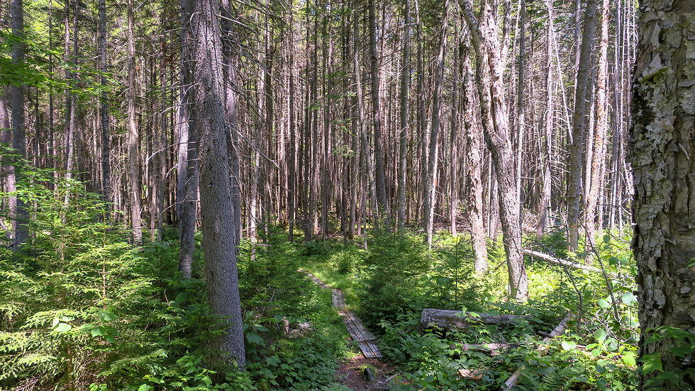
Day six found me hiking through several public easements with active logging operations. This was disconcerting at times but a good reminder that much of this trail used to follow logging roads. Loggers and their machinery probably used to be a much more common feature on the trail. Late in the morning, I climbed to the highest point on the entire NPT. The section from there to Long Lake was wonderful. I loved the pine forests with mossy undergrowth.

The network of boardwalks and bridges through some of these stretches were quite impressive (thank you to those who maintain these!). I arrived at 28N around 1:30 and walked into Long Lake to retrieve my last mail drop and meet Rashna. After a delicious ice cream cone from Custard's Last Stand and a change into some less stinky clothes, we headed home to Glens Falls.
Some general thoughts on the trail
This trail was a real adventure. I saw so few people that I felt more isolated than I usually do when hiking. My other major experiences with long distance hiking have been on the Long Trail and the Appalachian Trail where there were frequently many people at each shelter and throughout the trail generally. I knew this wouldn't be a social experience but it was still a stark difference from hiking in the high peaks. The trail had very little elevation gain but its remoteness meant frequent blowdown often took extra time to navigate around. I found the trail to be extremely well-marked in most places (although occasionally distances displayed on signs didn't match with my map or guidebook). This being a fairly low-lying trail near many bodies of water, the bugs were intense at times. I was prepared for this but I'd love to visit some of these areas in the fall or winter where insects would be less of a factor. I'm not sure I'd recommend parts of this trail to someone who had bad reactions to bug bites, at least not as a summer hike.
I'm excited to finish the last section of the trail, hopefully in a few weeks. Having hiked in the Seward Range and the Santanonis, I've seen signs for Cold River, Duck Hole and the like. It will be fun to finally visit these places and hike between these two ranges. I've also stayed at campsites along Long Lake when canoeing so I know how beautiful it is. It's good to have something to look forward to and the mountains aren't going anywhere!
Update: I finished the trail a few weeks after this trip concluded. I did a write-up of those final 38 miles or so here.


Comments